9.13.2012

Waddington Range - Stiletto Peak, The Blade


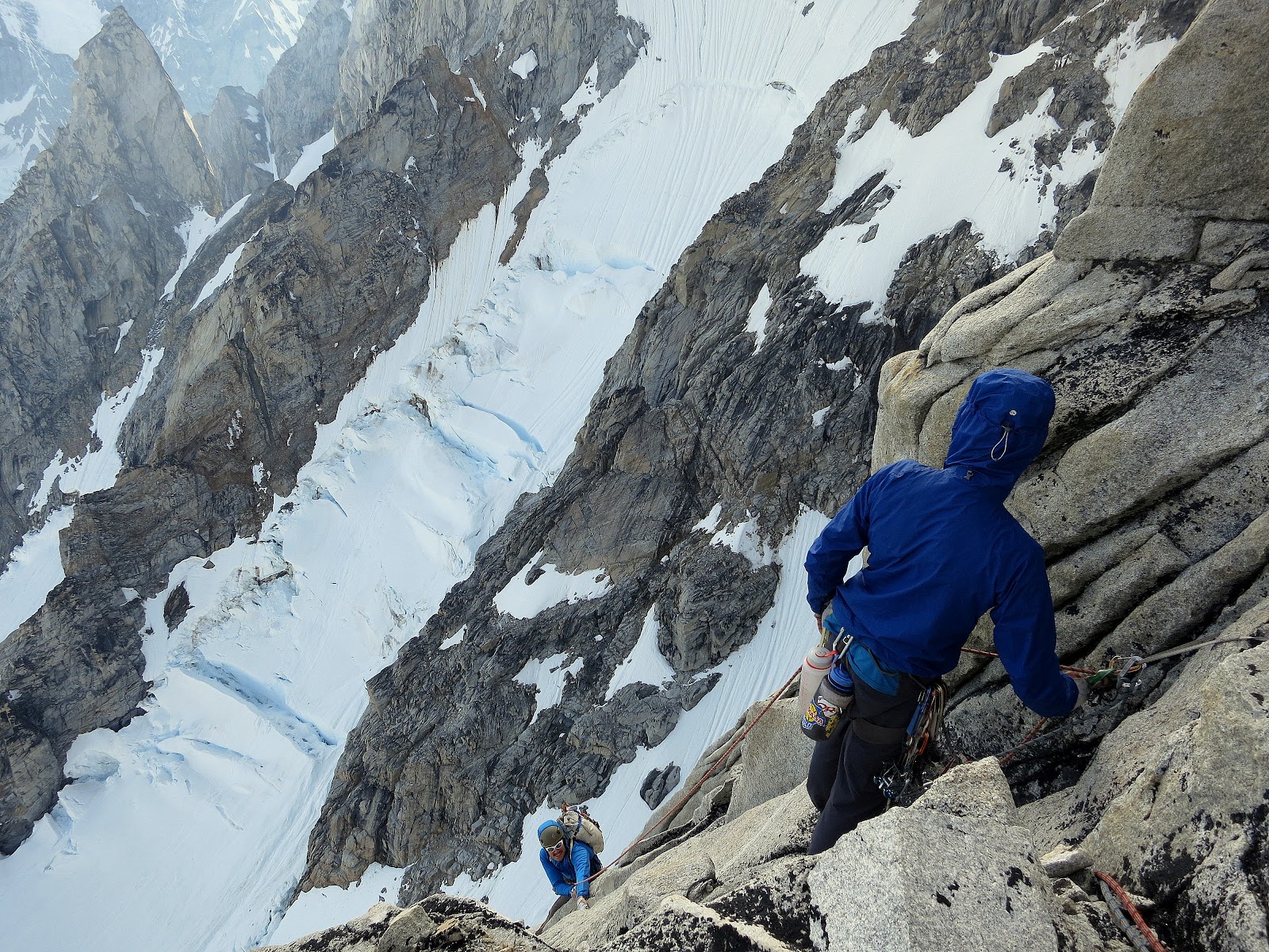
While in the Waddington Range we'd hoped to try a new route on the South Face of Asperity, well to the right of the 2011 Elson/McClane route. However, after getting forced onto the rock on a buttress toe below the face proper, we spent 7 pitches and 7 hours in getting dead-ended on plan #2, and we did eventually reach a spot below our original destination, the South face. By this time we'd already dealt with the glacier and ice of the lower Tiedemann/Asperity Couloir in the pre-dawn hours, but a narrow snow couloir we'd have to cross was running with slush-a-lanches and big blocks. We stayed on a shaded rock ledge and watched the evening pass, deciding what to do. Not only did we think that the rock on the South Face was loose and sharp, but also quite blank. Our best options seemed to be the major fractured weaknesses, some of which ran with water. I think that a few thousand years of active glacial scouring along these steep upper couloirs had scraped the wall clean and left few open cracks or holds. Other faces which were higher on the peaks (or not exposed to such active snow/ice scouring) were more climbable. We bailed back to Sunny Knob and had an awesome rest day as the mountains continued collapsing around us.


(We had each placed bets on which bit of the ice fall was next to fall off)

The two new routes that we did climb on the trip were not particularly long (450-500m each on rock above our wandering, mostly non-technical approach via the lower Stiletto Glacier) but they did tackle two of the steepest sections of stone in the area and were done onsight and free with one point of aid. [edit: the above makes more sense if written "onsight and free, apart from one point of aid". ]
Here are a few photos:


9.03.2012

Mazama, WA - The Fire Wall

Firestarter (.12c) and the heart of the Fire Wall
There are a number of excellent "sleeper" sport crags scattered around WA, and the Fire Wall of Mazama is one of them. In fact, 4 of Washington's 5 best sport climbing walls are located away from any major towns, often accessed via private land, and not included in any guidebooks.

 (My top 5 would be WWI, Nason Ridge, Newhalem, Equinox, and Fire Wall - the limestone out in the NE doesn't count only because I haven't visited it.  I know I'm probably missing several more!)

I got the chance to visit the Fire Wall yesterday morning with a few Leavenworth buddies. This wall has seen the area's two hardest single pitches established this summer, when Ben Gilkison climb a long-standing project, following a blue streak of pockets above the anchors on Firestarter. (5.13c) Shortly after that, Joe Kinder bolted a route just to the right which rides a right-trending "wave" of stone, and goes at 5.14a. Nice work guys!

We had a fun few hours on the left side of the wall, climbing and being pleasantly cold. The wall sports very little sun (none until 2:30 at this time of year) and a beautiful waterfall along the crag's left end. I managed to onsight the area classic, Firestarter, but didn't venture above onto Ben's new route. However, knowing how to get here and being aware of the aspect and quality of the routes, I'm definitely keen to return.


The Approach:

Drive ~4.7 miles up the valley from the Mazama Store on Lost River Road. After the Goat Wall parking/climbing, but well before the airstrip or the snow-park, you'll cross an unmarked creek that flows under the road year-round. This is Gate Creek. Park before this creek on the down-valley side of the creek crossing. A well-used trail leaves the road 40 yards  down-valley from where Gate Creek flows under the road. Follow this trail, going straight (ie DO NOT take the one possible hard right turn) for 30 minutes through the woods, and then up talus immediately to the right of the creek bed. The wall is just right of the creek.


All routes are closely bolted or sport fixed draws, so even without the guidebook you wont have much trouble just climbing yourself into oblivion. We consistently had more fun on routes than we thought we would, and enjoyed the movement and holds more than we may move guessed from the ground. 

8.28.2012

Skywalk Buttress - Combatant


From a base camp at Sunny Knob, low on the Tiedemann Glacier, all four members of our motley band (myself, Forest Woodward, Graham Zimmerman, and Scott Bennett) packed for 4 or 5 days and headed up to the Waddington Tiedemann Col (edit, Wadd/Combatant Col).


Skywalk Buttress on the SW Peak of Combatant
We occasionally caught the tracks of our friend Colin Haley, who'd tromped up the glacier solo a couple days prior, after flying into a spot farther east. We planned on only having to end-run a few big cracks, but we ended up too high on the left side of the upper glacier, cut off from our intended route and running out of light. We set up camp between crevasses and began the next morning with a bit of downclimbing and a rightward traverse below the rock tower that divides the upper glacier. 

Waking up after our surprise night on the upper Tiedemann, Bravo Peak behind.

Forest self-belays on a grigri, bollard anchor in place.
Navigating the upper glacier was slow and tedious, requiring a few sections of two-tool climbing. We managed to (mostly) make it through before the sun came high in the sky, but the icefall faces due east, so gets early light.


The Waddington Tiedemann col is an enormous plain of snow, fringed to the North and South by bergschrunds, moats, and peaks thousands of feet above. To the East and West, the horizon drops precipitously. It's exemplary of a natural wind tunnel.


Setting up at the col, McNerthney Pillar in top right.


We got our tents set up and made a late breakfast, quickly racking for the climb. 

Ice start in center
I lead up a short bit of vertical slush through the bergschrund, and belayed the three others up off a rock-pro and sno bollard anchor, tagging the ice tools down each time. Forest and Scott began via the 5.10- Gilmore/Mahoney left-side start, and with ice tools and boots, I lead the traditional ice start, finding easy water ice and fun mixed rambling for 2 pitches or so.

 Graham just "hand jugged" the rope when he couldn't climb nearby rock in his approach shoes.
Graham hand-over-hands on an ice section of the Skywalk.

Our two variations soon met up on the crest, and both teams cruised pitch-after-pitch of 5.8 and 5.9 climbing. 
Graham on the first rock pitch, overhanging patina face climbing!
We took the zig-left, zag-right variation roughly 1/3 of the way up, and a huge belay terrace on the crest provided another nice landmark, 2/3 of the way up.

Between these two landmarks, we encountered our only route-finding issue. In the vicinity of several large square roofs, climb rightward across a gray slab, and blindly move around the prow into a hidden right-facing corner. This corner makes up one of the best pitches on route.

We all finished via a novelty overhanging boulder-problem on the crest, and celebrated with some snacks and a discussion of how tiny our expedition tents appeared (identical to dust specs in our photos).


We rappeled roughly 105 meters down East from the summit, then made many raps down the fall line (Southish), attempting to stay on the rock ribs that separated snow and ice couloirs, skier's right of the great Combatant Couloir. We didn't find much in the way of anchors, but I did recover a couple antique slung stoppers. Forest got a lesson in night rappels, as we employed everything from V-threads to bollards, bootied pins, and bashed-in wires to make it down and over the moat and bergschrund.


Overall I'd describe the route as an excellent granite-ish face climb in an unforgettable location atop the range. It reminded me of climbing the West Pillar of Cerro Pollone in Patagonia, although it was much lower-angled and easier, and didn't feature as many crack systems. The rock is impeccably clean, and although no single pitch would stand out as an excellent cragging route, they each provided stretches of truly enjoyable climbing.


Graham, and Perseverance's prow.
We had hoped to attempt the 2nd ascent of Perseverance (Cusick-Kearney), also on Combatant, but a worsening weather forecast and a closeup view of the route dissuaded us from an attempt. In addition to  difficulties getting to the rock, the route appeared to feature sustained down-sloping holds and slabs, interspersed with small overlaps. 

It (and Belligerence) also intersect a large scree and talus bench on which one could walk from the col, detracting from the commitment and singularity of the route high on the face. On Waddington's side of the col, the McNerthy Pillar and the ice/snow route just left of it both appeared compelling objectives without anything close to an "early escape" option.

Leaving the col to begins our raps
To return down the Tiedemann, we made 2 rappels and some downclimbing from atop the rocky tower that divides the upper glacier.

 We veered skier's left, walked on snow beneath Perseverance and the Incisor/Belligerence.


The four of us made it to Sunny Knob at dark with only one hair-raising moment as a HUGE serac-a-valanche swept off of Waddington and started a temporary Niagra falls of slushy mountain debris. We were never within its path, but from our jumbled vantage point, it was easy to believe otherwise.


8.23.2012

Reflections on The Waddington Range


I just returned from a few weeks in the Waddington Range of British Columbia. These mountains were described to me a few years ago by Mikey Schaefer as "way wilder" than Patagonia, and a "Karakoram experience 8 hours from Seattle." While Mikey may have been a little optimistic regarding the drive time (it took us ~11 hours from Vancouver to the helicopter hangar) I think his impressions of the range were spot-on. Despite not being able to go to Tahu Ratum, in Pakistan, as we had originally planned, Scott Bennett, Graham Zimmerman, and myself overcame VISA holdups from the consulate and various injuries to have a great trip, establishing some new routes and repeating a couple area classics.

Here are a few photos:


7.29.2012

New Old Classics


This summer I've attempted two new routes on the peak Colchuck Balanced Rock in the Stuart Range. The first attempt ended after onsighting 4 new 5.10 pitches, but ripping off a dinner-plate flake and falling somewhere in the neighborhood of 60 feet. With a sprained ankle that nearly didn't fit into my boot (following a sleepless night of swelling) I spent 9 hours hobbling back down to the car. Ibuprofen (or a charged iPod) would have been nice.

But redemption came last weekend in the form of a new route and some of the best pitches I've climbed in the Cascades.

7.09.2012

Liberty Crack - Liberty Bell

Liberty Crack, Liberty Bell spire in the North Cascades

Summer usually starts in the Northwest on July 5th, and this year was no exception. Faced with 100 degree forecasts and a still-injured ankle, my wife and I headed up to the spires at Washington Pass where we hoped to find no bugs, cool temps, and short approaches. We still got fried by the sun, but 2/3 is good enough.

6.26.2012

A New Route in the Stuart Range - The Valkyrie

"Hey Scott, do you want to just try and climb a new route?"
"Um yeah, that's fine." 
And so that's what we did.


6.23.2012

North Ridge of Mt. Stuart


I made a late-spring climb of the North Ridge of Mt. Stuart the other day with Scott Bennett and Graham Zimmerman. It was their first time on the mountain, and we found it 90% snow free.